Waterloo: Papelotte Map Adjustment
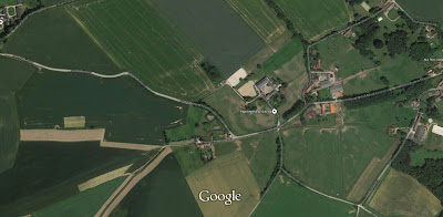
A closer view clearly demonstrates the farm house today and it's orientation to the road - Chemin de la Papelotte. Contrasting this photo to older records (photos), sketches and the Hovels Ltd model and it is clear how to orientate the building - the outer courtyard being where the similarly sized square of heavy vegetation to south is today. What also becomes clear is the relative inacuracy of Adkin's map in his Waterloo Companion is for the placement and orientation of Papelotte.
There will be no substitute for use of the model itself in precisely locating placement of Papelotte on my terrain. Nevertheless, I have shown the amendment of the position and some fiddling with my proposed hedges and crops.


Comments
Post a Comment